
Updated geoconverter: { geoJson } <> { arcJson }
Update (2025):
This post describes a workflow I built in 2014 for converting GeoJSON ↔ ArcJSON using a custom tool.
Some of the external services mentioned below — including the City of Fort Collins ArcGIS REST endpoint used in the example — are no longer available.
I’m leaving the post up as an archive of the workflow and tools from that era.
I put together a simple geo-converter a while back (and posted about it) to convert GeoJSON to ArcJSON/EsriJSON. I originally needed it to get some polygons into an ArcGIS Feature Service.
I later updated that converter to handle ArcJSON → GeoJSON as well. At the time, I used it to pull ArcJSON from an ArcGIS Feature Service (via the REST API) and convert the results into GeoJSON.
The GeoConverter Tool
https://brightrain.github.io/geoconverter
source
It’s a lightweight wrapper around Esri’s GeoJSON Utils library.
Example workflow (archived)
In the original version of this post, I demonstrated the workflow using the City of Fort Collins ArcGIS REST services. That service is no longer available, but the general idea was:
- Run a query against a Feature Service using the REST API
- Retrieve geometries in ArcJSON format
- Convert them to GeoJSON using the converter
- Use the results to build a map (in my case, a Mapbox map)
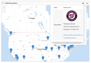
Sample GeoJSON (still works)
If you want something to experiment with, here’s a sample dataset:
Major League Baseball Stadiums:
https://gist.github.com/brightrain/9533708#file-mlbparks-geojson
Still one of my favorite little “bridge” tools from the era when GeoJSON wasn’t yet supported in the ArcGIS ecosystem.
Play ball!